Day 2
8 April 2016
Big data and space debris – day 2
09:00AM
Keynote – Peaceful uses of outer space
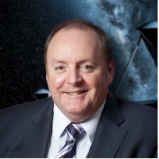
Dr David Kendall
Chair
UN COPUOS, 2016-17
Space science and space applications advance our knowledge of the universe. They also improve the daily lives of people worldwide through their contributions to environmental monitoring, management of natural resources, meteorological forecasting, climate modelling, satellite navigation, communications, and early warning systems to help mitigate potential disasters. If the international community wishes to increase access to the benefits of current space applications, and develop new technologies which may offer further benefits, there is a need to preserve and protect the outer space environment for use by future generations. Space activities need to be sustainable over the long term.
Throughout the years, the Committee on the Peaceful Uses of Outer Space has considered different aspects of the long-term sustainability of outer space activities identifying areas of concern for the long-term sustainability of outer space activities, proposing measures that could enhance sustainability, and producing voluntary guidelines to reduce risks to long-term sustainability. It has addressed thematic areas including sustainable space utilization supporting sustainable development on Earth; space debris, space operations and tools to support collaborative space situational awareness; space weather; and regulatory regimes and guidance for actors in the space arena.
09:30AM
Space data in the cloud
In this session we will focus on space data and its access to the ‘European Open Science Cloud’
This is perceived as a sustainable infrastructure for the management and long-term stewardship of research data, with the final aim to accelerate discovery and innovation. Science in Europe should be supported by the infrastructure and it should make existing data infrastructures in different domains more interoperable. The infrastructure should obviously be placed in global context. Also, it will have to support controlled access to data where this is needed for reasons of privacy or data protection
10:00AM
SKA – the largest space data project in the world
Dr Phil Diamond
Director General
SKA Organisation
In 2018, a group of organizations from all of the world will begin construction of the largest radio telescope ever built, the Square Kilometre Array (SKA).
The Square Kilometre Array (SKA) will, when complete, be the largest scientific facility on, or off, the Earth. It will be physically huge, spanning two continents and generating data volumes many times greater than that of the entire internet.
With one million square meters of collecting area and enough optical fiber to wrap around the Earth twice, this marvel of modern engineering will be sensitive enough to detect airport radar on a planet 50 light years away. SKA will also generate 700 terabytes of data every second. At full capacity, the SKA’s aperture arrays are expected to produce 100 times more data than the entire Internet. It doesn’t take a rocket scientist to realize that such a deluge of information creates a big data problem, perhaps the biggest we have ever encountered.
Solving this big data problem for the space industry requires innovation in the data storage, processing, and access (or visualization) technologies, which, in turn, creates ample opportunities for startups and large data crunching companies to take advantage of.
Dr Phil Diamond will discuss the scientific motivation for SKA, the international partnership and the observatory that will be built. He will summarise the current status of the detailed design of the SKA and highlight the timeline for the project, including the start of construction planned for 2018.
10:30AM
Networking break
11:00AM
Big data – availability, accuracy and processing technologies
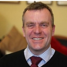
Mark Rawlins
Director of Communication System Operations
Eutelsat
In this session we will debate the availability, accuracy and processing technologies of space big data
How the concept of sharing economy will develop in the geo-business by mobilizing underused assets — satellite constellations, UAVs, and other aerial imaging platforms — and essentially creating a new revenue channel for data owners.
We will also look into the Copernicus programme and how this will be a game changer to the current ecosystem.
Copernicus consists of a complex set of systems which collect data from multiple sources: earth observation satellites andin situ sensors such as ground stations, airborne and sea-borne sensors. It processes these data and provides users with reliable and up-to-date information through a set of services related to environmental and security issues.
The services address six thematic areas: land, marine, atmosphere, climate change, emergency management and security. They support a wide range of applications, including environment protection, management of urban areas, regional and local planning, agriculture, forestry, fisheries, health, transport, climate change, sustainable development, civil protection and tourism.
11:30AM
Panel – Data in meteorological and environmental surveillance
Nick Lambert
Consultant
Nick Lambert Associates
A few major factors will drive exponential growth in the amount of terabytes falling on us from the skies over the next couple of decades: the increasing speed of commercial satellite deployment, implementation of faster communication technology, and the onset of interplanetary missions.
The dwindling cost of launches and the democratization of the satellite market are going to result in an unprecedented growth of orbital activity. Based on announced plans by various companies and space programs, between 2,000 and 2,750 cube- and nano-sats will be launched by the end of this decade.
Most of the new spacecraft will have commercial applications, particularly in Earth observation, remote sensing and mapping. This will mean images and video, often multi-spectral or even 3D, which are some of the heaviest “packages” in terms of data units involved.
In this session we will explore how maritime surveillance and mapping is shaping the way we automate the process of monitoring environmental change, land use and classification.
12:15PM
Lunch
01:30PM
Space surveillance and debris mitigation
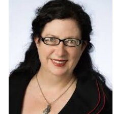
Dr Alice Gorman
Space Archaeologist
Flinders University, Australia
As we move into a more connected world dependent on satellite information, the rise of small satellites, we will see more and more objects in orbit.
This will create a significant environmental problem as we find a large number of space junk or orbital debris. Something will need to be done about it before space gets too congested. Dr Alice Gorman, in this session, will focus on the cultural significance/heritage value of space junk.
Dr Gorman will contribute a cultural-heritage perspective to international agreements on reducing the orbital debris problem
Watch Dr Gorman’s interview on TEDx Sydney: https://bit.ly/1XrxasG
02:00PM
Debris environment modelling
Prof Massimiliano Vasile
Marie Curie ITN ‘Stardust’ Coordinator
Stardust Network, Strathclyde University
The prediction of the damage, the future evolution of the orbit of debris and asteroids and their response to a deflection/removal attempt require modelling of the dynamics and dynamic environment, the long term simulation, the modelling and simulation of the possible damage including re-entry and impact on ground
Scientists continue to develop and upgrade orbital debris models to describe and characterize the current and future debris environment. Engineering models, such as ORDEM 3.0, can be used for debris impact risk assessments for spacecraft and satellites, including the International Space Station and the Space Shuttle. Whereas, evolutionary models, such as LEGEND, are designed to predict the future debris environment. They are reliable tools to study how the future debris environment reacts to various mitigation practices.
In this talk, Professor Vasile will introduce this research area that forms the basis of every analysis or tool that aims to predict the evolution of the debris environment, the danger of an actual impact with an asteroid, the consequences of a deflection or removal action.
02:30PM
Networking break
03:00PM
Panel – Space debris standardization
The most effective short-term means of reducing the space debris growth rate is through the prevention of in-orbit explosions.
The only effective long-term means of stabilising the space debris environment at a safe level is through the removal of mass (five to ten large objects per year) from regions with high object densities and long orbital lifetimes.
Both types of mitigation measures need to be applied broadly and in a timely manner to avoid uncontrolled growth of the debris environment. If mitigation concepts are applied insufficiently, or too late, some orbit regions, particularly the valuable 800- to 1400-km altitude, may experience a collisional cascading process that could render these regions too dangerous for space activities within a few decades.
In this session we will focus on the international effort currently being done to minimise space debris.


